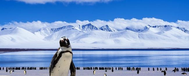
Greenland nature |
|
There are only two large areas of land covered by permanent ice on the globe - the island of Greenland and the mainland of Antarctica.
Until the 1980s, geographical science did not have accurate data on the nature of the interior, ice-covered regions of Greenland. The travelers were unable to penetrate deep into Greenland, to cross the Greenland ice sheet (this is the name of the ice mass covering the island).
What is now known about the Greenland ice sheet? For thousands of years, the island has accumulated snow, which is not upsetting during the short summer. Compressed under the pressure of its own gravity, the snow turned into colossal layers of ice. The average thickness of the Greenland ice sheet reaches 1,600 meters, and in some areas - 2,500-2,700 meters. Of course, no one measured this huge ice mass with meters. The ice thickness was determined only with the help of modern geophysical methods, following the propagation and reflection of seismic waves in the body of the glacier. Scientists have calculated the volume of Greenland ice: it is equal to about 3 million cubic kilometers; if this ice is melted, then the level of the world ocean will rise by 8 m and the waters of the ocean will flood the low-lying shores of all continents. The surface of the Greenland ice sheet descends in steps from the center to the outskirts. It is believed that two or three centers of glaciation existed in Greenland and that the current ice sheet consists of two or three merged ice domes.
The surface of the glacier is very uneven. It is dissected by small and large (up to several tens of meters wide) cracks. Hidden by a thin cover of loose snow, they pose a great danger to the traveler. In summer, streams of melt water flow into cracks and gorges and often form meandering lakes.Closer to the outskirts of the shield, where the ice is thinner, in many places dark rocks protrude from under the ice - numerous rocky mountain peaks "nunataks"; in summer, mosses and lichens grow on them.
On the outskirts of the glacier, travelers met another strange phenomenon: for many kilometers the snow was painted red. It was the wind that brought red plant spores here.
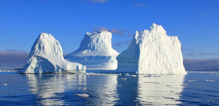
The Greenland glacier is constantly moving from the center to the outskirts. Unseen on large ice masses, this movement becomes quite perceptible in narrow glacial tongues, where ice often moves at speeds of up to 20 meters or more per day. When glaciers slide into the sea, from time to time huge blocks break off from them - whole ice mountains - "icebergs", reaching heights of 100 meters or more above the sea surface and up to a kilometer in length. In this case, the surface of the icebergs is from 1/3 to 1 / b of their underwater part (this depends on the shape of the iceberg and the density of seawater). Captured by sea currents, they wander over the waves for a long time, posing a great danger to oncoming ships, until they finally melt. The sinking of the Titanic steamer in a collision with an iceberg in 1912 is well known, when 1,513 passengers and sailors perished.
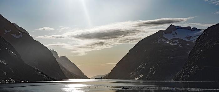
Many icebergs break off the Greenland glacier every day. Jakobshavn alone - the largest of the glacial tongues of West Greenland - annually dumps more than 1,300 icebergs into the sea, with a total volume of about 10 million cubic meters. meters. The loss of ice due to the formation of icebergs is compensated by snowfall. It is estimated that all Greenland ice is completely renewed every 6,000 years. Endless expanses of age-old ice - "white silence", cold blue fjords with majestic icy mountains, the silhouettes of which loom on the pale gold of the midnight sun - fascinate and at the same time suppress a person.
Close to the sea, the inner glacier rises over a considerable length of the northwestern coast, as well as on the southern and in many places on the eastern coast of Greenland. Here, the relief of the land underlying the glacier is such that it does not hold back the sliding ice. In other areas, the ice-free coastal strips of the island do not exceed 200 - 300 kilometers in width.These land strips are deeply indented by numerous fjords and bordered by islands and skerries. The coastlines on the western side of the island are especially winding. There are so many fjords here that in the southwest the coastline is almost ten times longer than its straight length.
The geological structure of ice-covered Greenland has been little explored. On most of the ice-free land, ancient crystalline rocks come to the surface - gneisses, granites, basalts, in some places covered by sedimentary deposits (sandstones, limestones). In the distant past, many areas of the island were the site of strong volcanic eruptions. In the area of the most powerful volcanic activity in the past - in the east, in the area of Scoresby Bay - hot sulfur springs with water temperatures up to 60 ° are still beating. Near the eternal ice - ever-hot springs ... Such are the striking contrasts of Greenlandic nature! Of the mineral resources of the island, the most valuable are large deposits of cryolite (a grayish-white soft mineral consisting of aluminum fluoride and sodium fluoride) in the southwest of the island, in the Ivigtut area. There are very few industrial cryolite deposits on the globe. Cryolite is used in the production of aluminum, being the best solvent for alumina. Deposits of marble, graphite (on the western coast of the island in the Upernivik region and in more southern places), asbestos (in the southwest, near Ivigtut), etc. are of industrial importance. There are copper deposits in the Ivigtut region; iron ore (magnetite) and some rare minerals (eudialyte containing zirconium) have been discovered in a number of places. In 1948, rich lead deposits were discovered in Greenland. The foreign press reported that the Americans had found uranium ore on the island. There are significant deposits of coal (lignite) on Disko Island (western coast). The climate of Greenland is peculiar, it is formed under the influence of many factors: the vast expanses of continental ice, and the enormous length of the island from north to south, and the proximity to its shores of warm and cold sea currents affect.
In the southern part of the island, located at latitudes corresponding to those of southern Scandinavia, winters are moderately cold: in Ivigtut (61 ° N), the average temperature of February, the coldest month, is -7.1 °, to the north of it - in Godthobe (64 ° N) -10.1 °, in Angmagssalik (66 ° N) - -8.0 °. The cold breath of the glacier is neutralized here by the relatively low latitude and warm North Atlantic current washing the southern shores of the island. Masses of cold air flow down from the glacier. But when mountain uplifts meet on their way, these masses of air flowing down from the glacier, oddly enough at first glance, heat the coast. The fact is that this creates dry and warm winds, called hair dryers, found in many mountainous regions of the world. Such winds occur when pressure is high on one side of a mountain range and low on the other. Under the influence of the difference in pressure, the air moves from a place of high pressure to a place of low pressure, passes over the ridge, rising along one slope and descending along the other. These are the conditions that exist at the edge of the Greenland ice sheet. It is further known that when it rises, the air expands and cools, and when it descends, it contracts and heats up.But when moist air rises, it cools more slowly when it rises than it heats up when lowering, since during the ascent a significant amount of heat is released from the condensation of moisture contained in the air. Therefore, the sinking air will be relatively warm and dry. In Greenland, there were cases when ice hair dryers raised the temperature on the coast by 20-25 ° for several hours. These phenomena are especially frequent on the southern shores of Greenland, which are often accessible to ships all year round. But in the north, winter is different. High latitude makes this time of year here very cold: the average temperature in February in Tula, at the 76th parallel, is -29.2 °. The eastern coast is warmer than the western one, because the winds passing over the warm North Atlantic current (Gulf Stream) bring warmth here.
The abundance of ice off the eastern shores of Greenland is caused by the removal of ice from the central regions of the Arctic into the Greenland Sea. Ice, which forms in large quantities in winter in the marginal Arctic seas (Kara, Laptev, East Siberian, Chukotka, Beaufort), is carried away by currents into the Polar Basin and drifts in a general direction from east to west. All this ice is carried out into the passage between Greenland and Svalbard. The continuous flow of ice in the Greenland Sea reaches a width of up to 400 km at the 80th parallel and moves at a speed of 3-4 km per day. At the 70th parallel, its width is reduced to 200 km, but the speed increases. Here the ice stream splits into two branches: one goes to the northeastern tip of Iceland, the other continues along the eastern shores of Greenland, bends around Cape Farwell and enters the Davis Strait. Moving to the south, the continuous stream breaks up into ice fields and separate ice floes. Ice moves in winter and summer. Summer in coastal areas is cool everywhere. The warmest month is July. In Ivigtut, the thermometer shows an average of 9.9 ° for July, 6.5 ° in Godthob, 7.1 ° in Angmagssalik, and 4.7 ° in Tula. Winds passing over warm sea currents bring with them a lot of precipitation in the south of Greenland — more than 1,000-1,100 mm. To the north, the amount of precipitation falls rapidly - in the middle part of the island it is 200-250 mm, and in the north only 100 mm. Such climatic conditions exist in the ice-free part of Greenland. On the ice sheet, climatic conditions are immeasurably harsher. They can only be compared with the climate of the colossal ice expanses of Antarctica. The low air temperatures on the Greenland glacier are mainly due to its high altitude. According to the observations of expeditions that have visited the center of the Greenland ice sheet, there is not a single month with positive temperatures, and the average annual temperature is -30 - -32 ° C. A very strong air cooling occurs over powerful ice masses. The cold, heavy air creates a constant high pressure over the Greenland glacier. Air masses spread from the center of the glacier to its periphery, to the sea. Therefore, fierce snow storms are common on the glacier, when the wind blows at a speed of up to 160-200 km per hour.
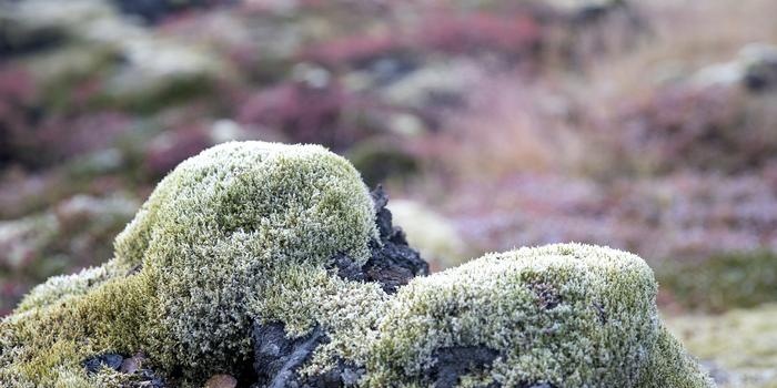
In recent decades, a noticeable climate warming has been observed in the polar regions.The reasons for it are not clear enough: some scientists associate them with cosmic phenomena (with the number of sunspots, with a change in the inclination of the earth's axis, etc.), others explain the warming by a change in the general circulation of the atmosphere. The warming also affected the climate of Greenland. Average temperatures have increased. In Jakobshavn (69 ° N), for example, the average annual temperature for the period 1881-1900. was - 6.3 °, and for 1936-1938. -5.1 °. The warming has led to the retreat of glaciers and a decrease in the ice coverage of the coastal areas of the sea. It is also noticeable in the living world: the number of cod in the Greenland seas has increased, the vegetation has become richer, the number of sea animals (seals, walruses), which loves cold waters and ice, is decreasing. Modern climatic fluctuations are, as most scientists believe, cyclical: periods of warming were observed earlier, but then they were replaced by a cold snap. In summer, the Greenland land is covered with stunted tundra vegetation: mosses, lichens, in the southern sheltered fjords and valleys - shrubs of willow, juniper, alder, dwarf birch. Even in the extreme south, the trees do not rise above 1-1.5 meters. Occasionally, the landscape is enlivened by meadows of bright flowers - poppies, saxifrage, dandelions, buttercups, bells. Plants tend to take advantage of the long sunny days of two to three summer months. Everyone who has visited Greenland is struck by the proximity of eternal snows and luxurious delicate flowers of various colors: marble-white, bright red, blue. The fauna of Greenland, as elsewhere in the polar regions, is poor in species, but rich in numbers. Only 33 species of mammals are known in Greenland. Before the arrival of European colonialists, the musk ox, or musk ox, was abundant on the island.
In the past, there were many reindeer and polar bears in Greenland. Today, only a few thousand of musk oxen have survived in the northern regions, and deer are found only in the southwest. Arctic foxes, hares, lemmings are almost everywhere on the island; less often - wolves, weasel. In summer, huge flocks of birds nest on the rocky shores.
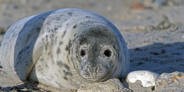
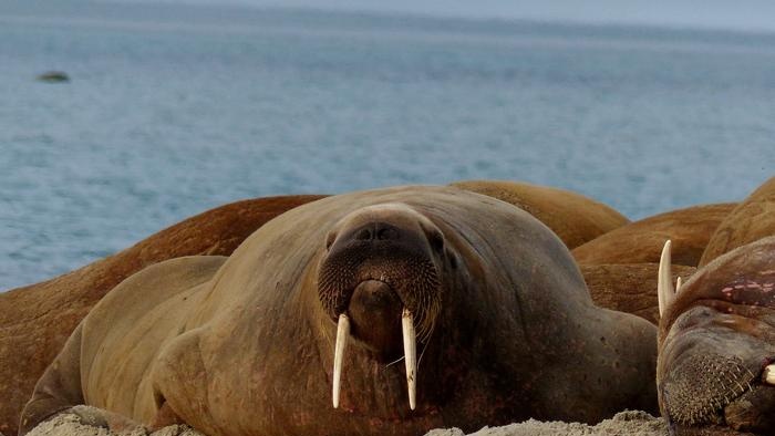
Bowhead waters were famous in the past for many large whales - the so-called bowhead or polar whales, reaching a length of 20 - 24 m and weighing up to 100 tons. After many years of predatory hunting, only small whales - the narwhal, belyxa - survived. Seals and walruses - typical inhabitants of cold countries - are found in large numbers, seals are widespread throughout the icy waters of the fjords, walruses are in smaller numbers, only on the western coast. The seas surrounding Greenland are rich in fish, especially cod, salmon, halibut and herring. Millions of years ago, the nature of Greenland was completely different. The fossils indicate that in the Tertiary geological era, a warm subtropical climate prevailed here, walnuts, elms, magnolias, laurels grew, thermophilic animals were found. Glaciation came with climate change at a later, Quaternary time.
Our scientists and polar explorers have made a great contribution to the study of the Greenland Sea. Many Soviet expeditions have operated in the Greenland Sea since the 1930s. In 1932-1934. the research vessels "Perseus" and "Knipovich" sailed here. In 1935, a large expedition to the "Sadko" worked in the Greenland Sea. Along the shores of Greenland drifted in 1937-1938. station "North Pole". The four heroic polar explorers (Papanin, Shirshoz, Krenkel, Fedorov), who landed at the North Pole, were carried out on the ice into the Greenland Sea and filmed at 70 ° 54 'latitude, several tens of kilometers from the Greenland coast. The ice drift lasted 274 days, and during this time 2,500 kilometers were covered. The history of polar expeditions has not yet known such a feat. For the first time, a systematic and most comprehensive study of the Greenland Sea was carried out. Its northern part had not been studied at all before. Agranat G.A. |
| Nature of Canada | Demerdzhi |
|---|
New recipes
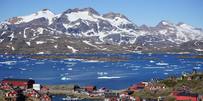 More than 80% of Greenland's territory is occupied by eternal ice. On this largest island in the world, stretching from north to south for more than 2,600 km (from Cape Morris Jesep at 83 ° 39 'N to Cape Farvel at 59 ° 46' N) and from the west to east - by 1 200 km and occupying an area of 2 176 thousand square meters. km, only narrow coastal areas are free of ice. The Greenland glacier covers an area of 1,800 thousand sq. kilometers.
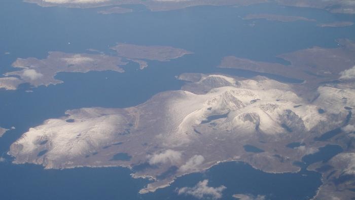
 Greenland is washed in the north by the seas of the Arctic Ocean (Lincoln Sea, Wandel Sea), almost constantly clogged with ice. In the northwest, narrow straits (Robson, Kennedy, Kane, Smith) separate Greenland from the Canadian island of Ellesmere Land. Further south, the distance between Greenland and North America increases: the Baffin Bay and Davis Strait separating them reach a width of several hundred kilometers. In the extreme south, Greenland is washed by the waters of the Atlantic Ocean, forming in the southeast the wide Danish Strait, separating Greenland from Iceland. Further to the north, the ice-rich waters of the Greenland Sea rise to the eastern shores of the island. From the extreme eastern point of Greenland to the coast of the Scandinavian Peninsula - more than 1,500 kilometers.
 The famous polar explorer Fridtjof Nansen first crossed the island from east to west in 1887. Other travelers followed him. Scientific stations were established on the Greenland glacier and operated there for many months. And yet, the nature of inner Greenland is still poorly understood.
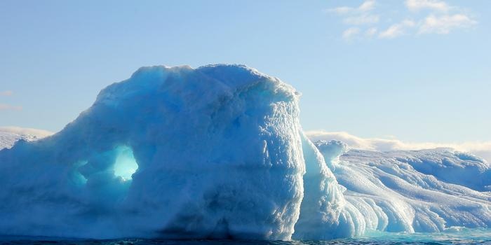 In the center of the island, under a layer of ice, lies a flat land surface that rises no more than 300–500 m above sea level. This plain rises towards the outskirts of the island. Thus, Greenland is like an oval bowl filled with ice. The ice sheet rises above sea level on average from 2,000 to 3,000 meters.
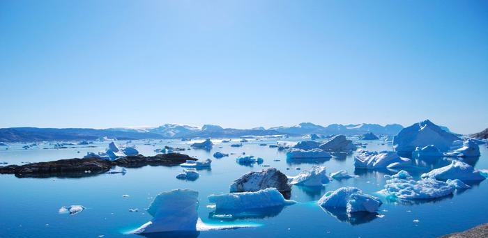 In some places, snow and ice are covered with depressions, which contain small particles of metal dust. This dust, called "cryoconite", contains iron, nickel and other metals. It is believed that it is brought in from outer space. "Meteoric" particles fall on the earth and in other places of the planet, but only here, in the ever-white expanse of snow and ice, can they accumulate in large quantities and become visible.
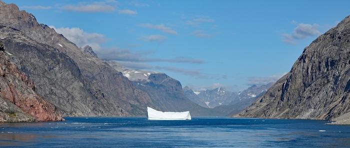
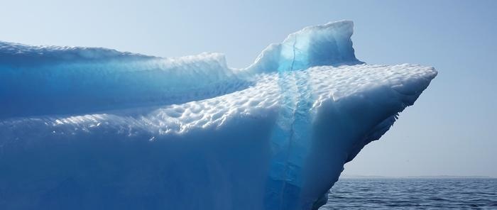 Majestic paintings can be seen on the outskirts of the ice sheet. When approaching the coast, the glacier spreads out in tongues, flowing into fjords deeply entering the land. Usually, these ice "rivers" are cut off in the coastal zone by a steep wall, often 100 meters or more in height. Streams of melted glacial waters polish the edge of the glaciers, washing narrow vertical troughs in it.
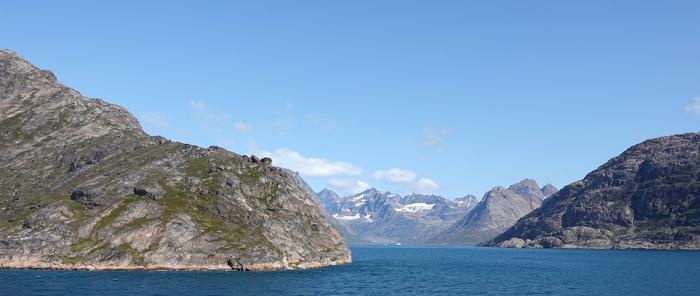 Since 1914, in the regions of Newfoundland and to the north of it, the cruising of special vessels of the International Ice Patrol has been organized, registering the movement of icebergs and notifying passing ships about it.
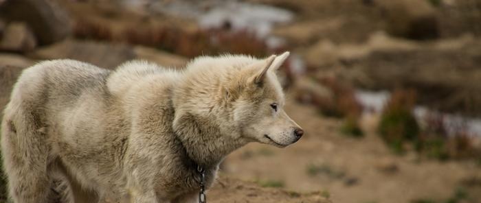 Only the western coast of the island, south of Godthob to Cape Farvel, is flat or slightly hilly, and it is here that the main settlements of Greenland are concentrated. In the rest of the ice-free areas, the coast of Greenland is mountainous and inaccessible. The highest elevations are located in the east: the recently discovered Mount Gunbjorn - to the north of Angmagssalik - 3,700 m above sea level, Mount Trout under the Arctic Circle - 3,440 m, to the north of it - Mount Peterman - 3,100 meters.
 Climatic differences in certain areas of Greenland are especially noticeable in winter.
 And at the same time, there is less ice on the western coast than in the east. This is the peculiarity of Greenlandic nature: where it is colder, there is less ice than in warmer regions. Thus, in Baffin Bay, despite the very low air temperature, in winter there are always large areas of clean water (the so-called "Northern Water"). This is due to the very intensive mixing of water, the rise of warm deep waters, which is primarily due to the presence of strong currents here.
 Atmospheric processes occurring over the Greenland glacier, as well as at the junction of the Gulf Stream and the ice flow in the Greenland Sea, are important factors shaping the weather and climate of Western Europe. For Western Europe and the adjacent maritime areas, Greenland is thus a "weather factory".
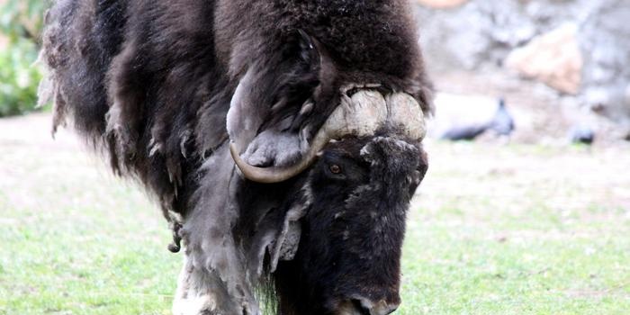
 The musk ox is an interesting mammal now found only in Greenland and the tundra regions of America. This short-legged animal of small stature (1.2-1.5 m) has a powerful, low-hanging head, large horns and very long hair. The wool and hide of the musk ox are highly prized. Its meat is also quite edible. The secretion of the bull's glands - musk - has healing properties and is also used as a flavoring agent.
 Of the 170 bird species found in Greenland, 55 species live on the island permanently. There are many eiders, polar partridges, polar owls, snow buntings, and crows.
 Greenland, as a "museum of Arctic nature", has always attracted the exclusive attention of scientists from many countries. The study of Greenland can provide a key to solving many problems of the Arctic - and not only the Arctic - nature. Knud Rasmussen is widely known among the explorers of Greenland - the son of a Dane and Eskimo, who constantly lived among the Eskimo people. Rasmussen undertook a number of long journeys around the island.